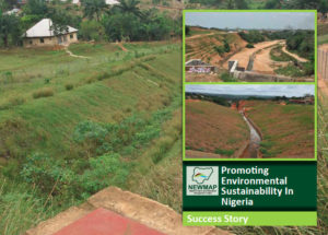
Dateline 11th July 2019: Owerri, Imo State Nigeria: Rt. Hon Emeka Ihedioha flagged –off implementation activities to address the Umuomeji, Umuturu, Ezemazu, Urualla gully erosion site with a ground breaking ceremony, held at Urualla in Ideato North Local Government Area (LGA) of the State.
Describing the devastating damage to large areas of ancestral lands and homes that have been ravaged and are being lost, and the possible loss that is bound to still occur if the erosion is not controlled. Ihedioha said this was why his administration “within its short lifespan approved the sum of #500 million Counterpart fund to ensure work commenced in earnest to address the psychological trauma and economic losses resulting from the devastating effect of Umuomeji, Umuturu, Ezemazu, Urualla gully erosion site,” which he stressed cannot be over-emphasized.
The governor therefore challenged the contractors to work according to approved design, while he called on the cooperation of the community.
“This is a new era in Imo state, and we intend to ensure that to a greater level, we tackle most environmental challenges confronting the state. This is why we are partnering with the Nigeria Erosion and watershed management Project (NEWMAP), Federal Ministry of Environment and the World Bank, Nigeria Country office to ensure that we restore back the resource base of the state.”
While he acknowledged the success of the NEWMAP in the area of tackling Land degradation Rt. Hon. Ihedioha solicited NEWMAP and the World Bank support for an emergency action in tackling the issue of Urban Stormwater in the state.
In the same vein, National Project Coordinator NEWMAP, Dr. Salisu Dahiru said the partnership, and the new collaboration extended by Government of Imo State was a bold step towards finding a lasting solution to the dehumanizing erosion problem in the State through the intervention of prioritized gully erosion sites.
He noted that the Umuomeji, Umuturu, Ezemazu, Urualla Gully Erosion Site in Urualla, Ideato North LGA of Imo State is one of the state’s prioritized gully erosion sites targeted for intervention early in 2016, but for some unforeseen issues implementation process was truncated until recent events.
Dr. Salisu who spoke on behalf of the Project and donor partners said the project “is aimed at the minimization of flood activities, rehabilitating and control of the gully from further expansion, rehabilitation of degraded lands (Flood Affected Lands) and their conversion into productive land as well as manage the watershed to redress the factors promoting gullying in the area.
According to him, public consultation reveals that Umuomeji-Umuturu, Ezeama, Urualla gully site in Urualla has led to destruction of farms, destruction of building and ancestral home, threats to the safety of all residents of all ages especially children and the aged persons/elders and massive damage to lives and property especially during epic of wet season.
However, the community has made several efforts in the past at controlling Umuomeji-Umuturu, Ezeama, Urualla gully from expanding but the magnitude of the required rehabilitation activities is beyond the capacity of the community.
The communities, however, expressed their readiness to corporate and work with Imo-NEWMAP in ensuring sustainable development of the Umuomeji-Umuturu, Ezeama, Urualla gully watershed.
The Ezemazu Urualla Gully Erosion can be traced back to the early 1980‟s, when the construction of the Urualla (Afri-bank to Umuturu) drainage was awarded and carried out. The drainage, which was designed to carry runoff generated from other neighbouring communities (Osina and Akokwa) through Umuturu down to Agwura Stream and Urashi River, was abruptly terminated. Due to the abrupt termination of the channel, the runoff generated within these areas resulted in the scouring of the unprotected soil that resulted in rill erosion. Consequently, the resultant sediment was transported into the Agwura and Urashi Stream. The slope of the gully area together with the nature, characteristics of the incipient soil and man-made interferences are the main causes of the gullies of the area. The topography of Umuomeji-Umuturu, Ezeama, Urualla gully site is characterized by the following:
A sloping land of about 5 to 8 % from north to center of the main Urualla gully;
A sloping land of 4 to 6 % from south to the center of the main Urualla gully; and
A sloping land of about 3 % from east to west.
Hydrological/Engineering studies showed that the total watershed area of the gully site is about 468.38ha. This area is shared amongst catchment 1, catchment 2 (Gully 1) and catchment 3 (Gully 2) respectively.
The proposed intervention will restore the socioeconomic lives of the people. Access to community facilities and infrastructures will be enhanced while the entire ecological landscape including stream flow will be restored and redesigned. Above all, through all these, the sustainability of the environment will be enhanced.


